 ultimate-guide
The Buyer's Guide to a Licensed Insured Drone Photography Service
Last Updated: November 1, 2026
Quick Summary
A licensed insured drone photography service pairs an FAA Part 107 certified remote pilot with aviation liability coverage, so every flight is accountable and every image set is defensible. Verify the pilot through the FAA public airman registry and get the certificate of insurance sent directly from the broker before the first flight.
- Verification takes about ten minutes, and any legitimate operator will welcome it.
- A general business liability policy typically excludes aircraft operations, so ask for aviation liability.
- A $1,000,000 per-occurrence limit with a $2,000,000 aggregate is a common small-operator structure.
- Many operators have a two-hour or half-day minimum because mobilization costs the same regardless of flight length.
- Book flights with room to reschedule when a lender draw or investor meeting depends on imagery.
Table of Contents
- Why a Licensed Insured Drone Photography Service Changes Project Communication
- How to Verify a Provider's FAA Part 107 Drone Pilot Credentials
- What Drone Insurance Actually Covers and What It Excludes
- Construction Progress Photos From Dirt to Completion
- Aerial Site Documentation: Repeatable Flights and Consistent Angles
- Interior Documentation Before the Drywall Goes Up
- What Drone Photography Cost Really Depends On
- Project Planning, Airspace Permissions, and Weather Contingencies
- Deliverables, Usage Rights, and Turnaround Time
- Request a Flight for Your Next Project
- Frequently Asked Questions
Why a Licensed Insured Drone Photography Service Changes Project Communication
A licensed insured drone photography service does more than produce attractive overhead images. It gives owners, builders, and property managers a repeatable visual record they can trust, defend, and share. At West Michigan Aerial Documentation LLC, we build every flight around that idea: the same angles, the same altitude, the same framing, flight after flight, so progress is measured rather than guessed.
Phone photos from the jobsite feel free until you need them. They are inconsistent, undated in any reliable way, and impossible to line up against last month's shot. Aerial documentation solves that. According to the Federal Aviation Administration's Part 107 overview, commercial drone work requires a certified remote pilot operating under specific rules, which is the first line of accountability a serious provider should meet.
The difference shows up in communication. Instead of describing a delay or a milestone in an email, you send a dated image set that shows exactly what changed. Owners and investors see the same thing you see, at the same moment, from the same vantage point. That single shift reduces back-and-forth more than any report template ever will.
Our work spans aerial progress flights and interior documentation before drywall conceals the framing, wiring, and plumbing.
How to Verify a Provider's FAA Part 107 Drone Pilot Credentials
Verification takes about ten minutes, and any legitimate operator will welcome it. The FAA Part 107 remote pilot certificate is the baseline credential for commercial drone work in the United States.
Here is how we would verify a provider if we were hiring one:
- Ask for the pilot's FAA Airman Certificate number and confirm the remote pilot status directly through the FAA's public airman registry.
- Confirm the certificate is current, not expired or suspended.
- Ask whether the person flying on your site is the certificate holder or an employee operating under their supervision.
- Request the registration number for the unmanned aircraft system being flown.
Checking the Airman Certificate and Remote Pilot Status
A certificate number alone proves nothing. The registry lookup is what confirms it. Cross-check the name on the certificate against the person who will actually be on your property, because a company can hold a policy while sending an uncertified subcontractor to fly.
A common mistake is accepting a screenshot of a certificate. Screenshots are trivially edited. The registry is the source of truth, and it takes a minute to search. The FAA airman certification database is free and public.
What Drone Insurance Actually Covers and What It Excludes
Drone insurance is not one product. It is a stack of coverages, and the gaps between them are where property owners get exposed. A provider who says "we're insured" without specifying which coverages are in force is telling you almost nothing.
The stack usually has three layers:
- Aviation liability (third-party bodily injury and property damage). This is the core coverage. It responds when the aircraft injures someone who is not part of the flight crew or damages property the operator does not own or control. On a construction site, this is the layer that matters if a drone strikes a crane, a parked vehicle, or a neighboring structure.
- Hull or equipment coverage. This covers the drone, gimbal, camera, and payload against crash, loss, or theft. It protects the operator's equipment, not your property. A provider can carry strong liability and no hull coverage, and that is not necessarily a red flag, it just means they are self-insuring their hardware.
- Non-owned or rented aircraft coverage. Relevant when an operator flies a borrowed or rented aircraft. Ask whether the policy extends to the specific airframe that will fly your site.
The exclusions are where buyers get surprised. Common exclusions in aviation liability policies include:
- Property in the operator's care, custody, or control. If the drone damages a structure the operator is contractually responsible for, the claim may be excluded. On a construction site, whether the partially built structure belongs to you or to the general contractor changes how a claim is handled.
- Intentional or illegal acts. Flying outside FAA rules, beyond visual line of sight without a waiver, over people without authorization, in restricted airspace without clearance, can void coverage for that flight.
- Warranty and contractual liability. A provider who signs a contract promising a specific result may create liability the policy will not back.
- Wear, tear, and mechanical breakdown. These are maintenance issues, not insured events.
- Nuclear, war, and certain pollution exposures. Standard aviation exclusions that rarely matter on a jobsite but appear in the fine print.
A general business liability policy (commercial general liability, or CGL) typically excludes aircraft operations. A certificate that lists only CGL with no aviation endorsement usually leaves drone flights uncovered. Ask the provider to have their insurer confirm in writing that drone operations are included.
Reading a Certificate of Insurance for Aviation Liability
Ask for a certificate of insurance before the first flight, not after. Then read five things:
- Named insured matches the legal name of the company you hired, not a parent company, not an individual pilot, unless that is who you contracted with.
- Coverage type states aviation liability, not a general business policy. Look for the aviation policy form or endorsement language.
- Coverage limits are stated as per-occurrence and aggregate amounts. A $1,000,000 per-occurrence limit with a $2,000,000 aggregate is a common small-operator structure; larger commercial programs often carry higher limits.
- Policy dates show the policy is active on the date of your flight, not expired or pending cancellation.
- Certificate holder and additional insured status. Listing your company as certificate holder means you receive notice if the policy lapses. Being named as an additional insured is stronger, it gives you direct rights under the policy, but not every insurer offers it for aviation, so confirm before you require it.
A screenshot of a certificate proves nothing; certificates are easy to alter. Ask the provider to have their broker send the certificate directly to you, and call the broker's number on the certificate to confirm the policy is in force. That two-minute call is the single most reliable verification step available to a buyer.
Liability-Only vs. Full-Coverage: What It Means for Your Project
Many small operators carry liability-only coverage because hull coverage on a professional drone can add meaningfully to the annual premium. That is a legitimate business choice, but it changes your risk picture. If the drone crashes into your property, liability coverage may respond to damage to your property (subject to the care, custody, and control exclusion), but the operator's lost equipment is their problem, not yours. What you should care about is whether the liability limit is high enough for the worst realistic event on your site, and whether the policy actually covers commercial drone operations rather than hobby or recreational use.
Before the first flight, get three documents: the certificate of insurance sent directly from the broker, written confirmation that drone operations are covered, and the policy's per-occurrence limit. If any of the three is missing, treat the insurance claim as unverified.
The coverage stack breaks down into three layers, each protecting something different.
| Coverage layer | What it protects | Note |
|---|---|---|
| Aviation liability | Third-party bodily injury and property damage | Core coverage; responds when aircraft injures someone or damages property |
| Hull or equipment coverage | Drone, gimbal, camera, and payload | Protects operator's equipment, not your property |
| Non-owned or rented aircraft coverage | Borrowed or rented aircraft | Ask whether policy extends to the specific airframe |
Construction Progress Photos From Dirt to Completion
Construction progress photos work best as a sequence, not a collection. The value comes from matching month one against month six from an identical position.
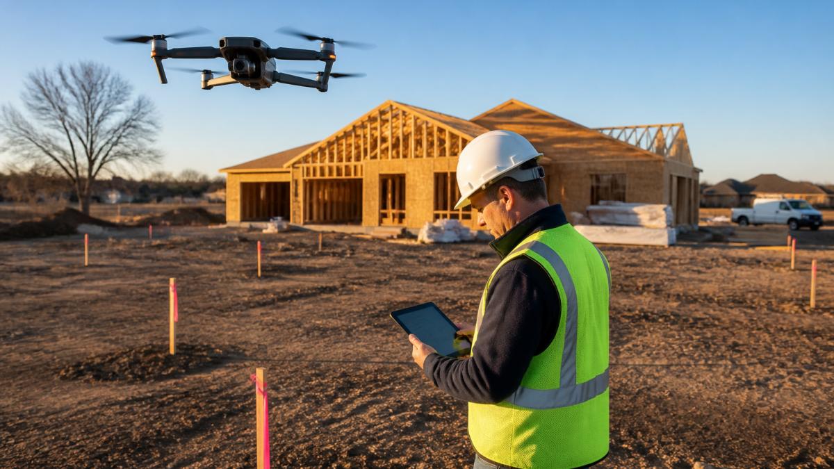
A typical sequence moves through clearing and grading, foundation and footings, framing, roof and envelope, and final site work. Each stage gets the same angles so nothing is lost to a shifted camera position. In practice, this means a lender draw request or an owner update can reference a specific image rather than a verbal description.
The alternative, someone on site snapping phone photos when they remember, produces gaps exactly when documentation matters most. A repeatable flight schedule closes those gaps.
Aerial Site Documentation: Repeatable Flights and Consistent Angles
Aerial site documentation is the practice of capturing a property from fixed, pre-planned positions at regular intervals to create a comparable visual record over time. Consistency is the entire product. Without it, you have a folder of nice pictures and no way to prove what changed.
Seasonal differences in light and foliage are unavoidable, but the geometry stays fixed. That lets an estate manager track capital improvements across years, or a developer compare grading progress against the original plan.
What most guides miss is that consistency has to be designed before the first flight. A provider who shows up and flies "around the site" cannot reconstruct last quarter's angle later. Ask any operator how they guarantee repeatability, and listen for a specific answer about waypoints and flight logs.
Interior Documentation Before the Drywall Goes Up
Interior documentation captures what will be hidden within days. Before insulation and drywall close the walls, a room-by-room photographic record preserves visible framing, electrical wiring, plumbing, HVAC runs, and wall blocking. Our guide on how to document construction progress before drywall walks through the process room by room.
For homeowners, this is a reference file for future repairs and remodeling. You can also preserve a room-by-room reference of exposed systems before insulation and drywall cover them. Need to know where a pipe runs before hanging a cabinet? The photos answer it without opening a wall. For builders and remodelers, it is protection: a dated record that the work was installed as specified.
Request a Flight or construction photography inside and out even in the air →
Watch out: photos taken without room labels or a date structure become nearly worthless within a year. Organization is half the deliverable.
What Drone Photography Cost Really Depends On
Drone photography cost depends on scope, and pricing depends on quantity, dates, and delivery. For a deeper breakdown of the factors that drive pricing, see recurring drone inspection costs. For current prices or a quote, contact West Michigan Aerial Documentation LLC through its website.
Hourly vs. Project Pricing
Providers generally quote one of two ways:
- Hourly or half-day rates. Common for one-time captures, event coverage, and small sites. The rate typically covers pilot time, equipment, travel within a local radius, and basic editing. Ask what the minimum booking is, many operators have a two-hour or half-day minimum because mobilization costs the same whether the flight lasts 20 minutes or three hours.
- Project or program pricing. Common for recurring construction documentation, where a fixed per-visit rate across a monthly schedule is more predictable than hourly billing. Program pricing usually bundles a set number of flights, a defined deliverable package, and a stated turnaround.
A flat published rate is rare in this market because the variables below swing the number so widely. A provider who quotes per project after understanding scope is usually giving you a more honest number than one advertising a headline hourly rate.
The Variables That Move a Quote
-
Flight frequency and duration. A one-time capture is a single mobilization. A recurring monthly schedule spreads mobilization across many flights but adds volume. Weekly progress documentation on a large site can cost several times a monthly program on the same site.
-
Site size and complexity. Acreage, number of structures, interior square footage, and obstructions all affect flight time and planning. A dense urban infill lot with power lines and neighboring buildings takes longer to fly safely than an open greenfield site.
-
Airspace and authorization. Flights in controlled airspace near airports may require FAA authorization, and that planning and lead time is real work. Sites in restricted or special-use airspace can add cost or make a flight infeasible without coordination.
-
Deliverable format. Stills only is the base case. Adding 4K video, edited highlight reels, orthomosaic maps, or 3D models increases both capture and post-production time.
-
Editing depth. Basic color correction and file organization is standard. Heavy retouching, compositing, or branded overlays are add-ons.
-
Interior documentation. Room-by-room interior capture before drywall adds significant time, often more than the exterior flight, because each room must be photographed systematically and labeled.
-
Travel. Providers typically include travel within a local radius and charge per mile or per hour beyond it. For recurring programs, travel is a recurring line item, so confirm the radius.
-
Usage rights. A broad license for marketing, reporting, and internal use is standard. Exclusive rights, resale rights, or restrictions on the provider's own portfolio use can change the price.
How to Compare Quotes Apples to Apples
Ask every provider to quote the same scope in writing: number of flights, deliverables per flight, editing scope, turnaround, travel radius, and usage rights. A lower quote that excludes editing or charges travel separately is not comparable to an all-in quote. Request a custom quote with your site details through West Michigan Aerial Documentation LLC's website.
The fastest way to get an accurate quote is to send the provider your site address, the documentation schedule you have in mind, and the deliverables your stakeholders actually need. Vague inquiries get vague quotes.
Project Planning, Airspace Permissions, and Weather Contingencies
Airspace and weather decide whether a flight happens, and a provider without a plan for both will leave gaps in your record. Controlled airspace near airports may require FAA authorization before flight, and that authorization takes time to arrange.
A common mistake is scheduling documentation around a hard deadline with no buffer. If a lender draw or investor meeting depends on imagery, book the flight with room to reschedule.
Deliverables, Usage Rights, and Turnaround Time
Deliverables should be specified in writing before the first flight. Ask what format you receive, how files are organized, how quickly they arrive, and what you are allowed to do with them.
Request a Flight for Your Next Project
The gap between adequate documentation and defensible documentation comes down to credentials, consistency, and planning. If your current record is a shared folder of phone photos, you already know how quickly it stops being useful.
West Michigan Aerial Documentation LLC is FAA Part 107 licensed and insured, and we build every engagement around repeatable flights from consistent positions. Our team delivers high-resolution aerial photography and 4K video from dirt to completion, plus interior documentation of framing, wiring, plumbing, HVAC, and blocking before drywall goes up.
Get started with West Michigan Aerial Documentation LLC by requesting a flight.
Frequently Asked Questions
How much does a drone photographer charge?
Drone photography cost depends on project scope, flight count, site size, deliverable format, and turnaround. A single marketing shoot prices differently than recurring construction documentation across a full build. Pricing depends on quantity, dates, and delivery. For current prices or a quote, contact West Michigan Aerial Documentation LLC through its website.
What license do I need for drone photography?
Commercial drone work requires a Remote Pilot Certificate under FAA Part 107. The FAA Part 107 drone pilot must pass a knowledge test, hold a current certificate, and follow operating rules including altitude limits and airspace authorization. Ask to see the certificate before booking, and confirm the pilot's name matches the operator on the certificate.
What should I ask before hiring a drone photography service?
Ask five things: whether the pilot holds a current FAA Part 107 certificate, whether the company carries aviation liability insurance and at what coverage limits, who owns the images and what usage rights you receive, what the turnaround time is for edited deliverables, and how they handle weather cancellations. Also ask whether they fly repeatable positions so construction progress photos line up flight to flight. A licensed insured drone photography service should answer all five without hesitation and provide documentation.
What does drone photography insurance cover?
Aviation liability insurance typically covers third-party bodily injury and property damage caused by the aircraft during operations, and many policies include coverage for the drone itself. Standard policies often exclude intentional acts, operations outside FAA rules, flights in restricted airspace without authorization, and some payload or data losses. Coverage limits and exclusions vary by policy, so request a certificate of insurance and read the exclusions before your project starts.
How can drone photos help document construction progress?
Aerial site documentation captures the whole site in one frame, showing grading, foundations, framing, roofing, and sitework as they happen. Flown from consistent positions, construction progress photos create a visual timeline you can share with owners, lenders, and investors without scheduling a site walk. They also support draw requests, dispute resolution, and future renovation planning.
How do I know the images will be consistent from one flight to the next?
Consistency comes from repeatable flight positions from one visit to the next. Ask a provider how they achieve this before you commit.